

Irma is expected to remain a powerful hurricane through the weekend
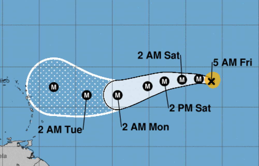
After rapidly strengthening on Thursday, Irma appears to have leveled off in intensity. The eye of the hurricane remains evident in satellite images, but it has occasionally been cloud filled. The deep convection in the eyewall has been fairly symmetric, and the Dvorak CI-numbers from TAFB and SAB have held steady at 5.5/102 kt. Based on these data, the initial wind speed remains 100 kt for this advisory. Although Irma is in a very low wind shear environment, the hurricane is moving over only marginally warm SSTs and is in close proximity to dry air. The models respond to these conditions by showing little change in strength or some weakening during the next couple of days. Thereafter, Irma is expected to move into a more favorable thermodynamic environment while remaining in low wind shear conditions, which should allow the hurricane to intensify. It should be noted that major hurricanes like Irma often undergo eyewall replacements that can cause fluctuations in strength, but unfortunately these internal dynamics can not be forecast with any accuracy. The NHC intensity forecast is identical to the previous one and lies near the high end of the model guidance. Irma is moving west-northwestward at 10 kt to the south of a subtropical high pressure system. This high is forecast to strengthen and build westward during the next few days, which should cause the hurricane to turn to the west in about 24 hours and then move to the west-southwest over the weekend. By the end of the forecast period, Irma is expected to move on the south side of the high, which should cause the storm to turn back to the west or west-northwest. Although the models agree on this overall scenario, they differ slightly on the strength and orientation of the high and the intensity of Irma. These differences have caused a fair amount of north-south spread. The NHC intensity forecast lies near the middle of the guidance envelope through day 4, but leans toward the southern end at day 5, in favor of the ECMWF and HCCA models. (National Hurricane Center)